Blog 2
Here we are again! Once more from the outset, the aim of this blog series is to systematically document the principles, process, and products of my experience in modeling the Blow-Me-Down Farm historic site – but you can read more of my introduction here to hopefully gain a better footing moving forward.
As you might have inferred from the title, many of the necessary steps involved with digitally modeling a landscape are gained from or modeled after the physical realities of a site’s history, itself. Before Charles Beaman - or any of his agrarian predecessors, for that matter - could ever farm this arable property along the Connecticut River, they would have first needed to prepare the earth, possibly amend the soil, and surely build various support structures in order to house any harvest along with any valuable tools. Put another way, a site’s ground must first be made workable – mirroring the necessity for any residences or farm buildings intended to service the land that must also be erected before considerable work can be initiated on the site. In the paralleled realm of digital site design and 3D modeling, I have sought to do likewise.
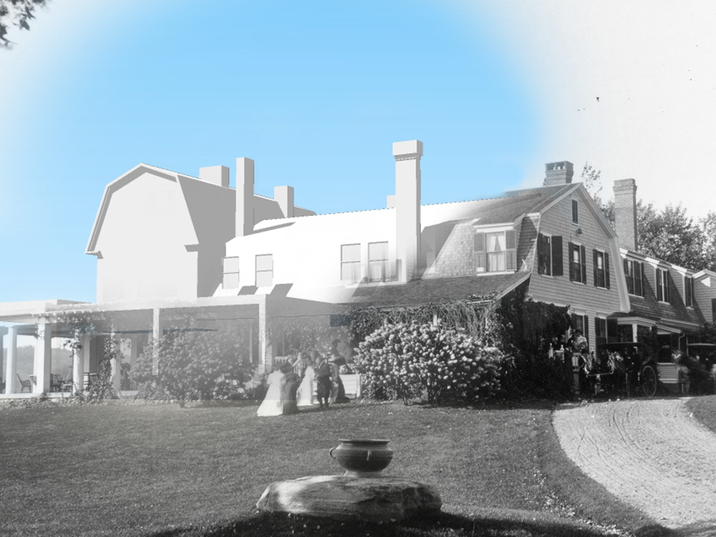
Raising the Barn.
Signature photograph taken in 1892 from Dingleton Hill to the Southeast of BMDF, looking over a hybridized landscape where the barn has been "raised" (in SketchUp).
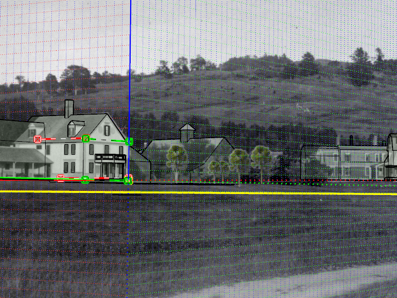
By starting with a basemap of aerial imagery, a rich dataset of historic period plans (drawn in Adobe Illustrator and AutoCAD), and a georeferenced SketchUp model, I was able to begin by framing out the location and character of each architectural component that would have been present on-site during the year 1917. This procedural step will be expounded in greater detail within the next blog post, but the essence of this task was to create rough building masses which will serve as true-to-scale and true-to-character placeholders in the absence of fully rendered buildings (depicting a particular NPS period plan). Each of the BMDF buildings have valuable stories to tell and deserve their own moment in the spotlight, but for the sake of time, they will tentatively remain as frames and masses – we are merely raising the barn, not filling it with cattle or painting its sides red… or at least not just yet. As a cultural landscape architect, I am more eager to yield the fruitfulness of a productive site rather than having fully-rendered buildings floating in 3D space – especially at this stage, when there’s a pressing need to put our boots on the ground and get to work!
Google Earth aerial/terrain with transparent overlay of a Period Plan map from 1917 to guide building placement and proportion.
Working the Ground.
The next step in the recipe was to introduce the topographic surface into the mix by means of a rather complex and tech-y process, summarized as follows: ASCII elevation points were extracted from a digital elevation model (DEM) through the use of ESRI’s ArcMap software. Once created, that ASCII point dataset was brought into Rhino, where a Python script/Command sequence called ASCIIGridImporter-AngleCellSize.py was applied. This tool in Rhino created a high-resolution terrain mesh from the ASCII point grid; and truth be told, this process ultimately proved to be a preferable method for keeping the file size workable, instead of extracting contours from the DEM which inevitably would crash my computer every time. Though the accuracy and level of detail embedded in this terrain surface has its own nuance, it also has its own falsehoods for my purposes of modeling a historic site (i.e. elevation data from 2015 does not always represent a site’s terrain from almost 100 years prior…). Many major changes occurred to the terrain since 1917, three of which include: (1) the historic River Road that BMDF connected to became realigned and resurfaced to become New Hampshire Route 12A around the year 1960, which altered the steep embankment of the property’s eastern edge bordering the BMD Pond; (2) the upper terrace upon which the BMD Cottage was built was regraded and leveled by one of the later owners after the period of significance (1917-1950) had ended; and (3) much of the site’s internal circulation system had been realigned or altered after the 1926 fire claimed the BMD Cottage, thus requiring the renovation and improvement to the Casino building as the new primary dwelling – this shift brought with it many landscape changes around the Casino grounds. As mentioned earlier, the next blog post will focus more heavily upon the site’s buildings and various perspective views – nevertheless, this post should unequivocally celebrate the site’s terrain surface and its modeling process.
Hardships, Simple Beginnings, and Dreams of Harvest.
Much like any arduous endeavor that requires tilling land by the sweat of your brow, there were also some difficulties and snags of their own sort that were experienced along the way in my 3D modeling process. I sympathized that no farmer ever ploughed the land and came away without some form of scar to tell the valuable story of how lessons had been learned along the way. My major frustrations were found in issues relating to file formatting and interoperability of softwares, such as exporting Adobe Illustrator to AutoCAD (CAD linework was created to the paper scale of the Illustrator drawing, needing to be rescaled to the sitedimensions), or importing Rhino to SketchUp (which simply doesn’t work as nicely as going from SketchUp to Rhino!). Though these lessons are insightful for the tools that I am leveraging, I recognize that the products they have created so far still remain rough and unhewn. I have a sense of looking over my newly prepared land and surveying its extents – breathing in deeply to catch my breath before the new day’s tasks beckon me to come and resume work. As trees don their fall foliage (now that it’s October in upstate New York where I am writing this), I reflect on how modeling the Blow-Me-Down Farm has already proved to be a fun and profound endeavor, with mini “seasons” ingrained into the fabric of its process. Even with these small beginnings I have achieved, I hold out hope that there will be a great harvest of deliverables to reap from this project.
Until harvest time comes, stay tuned for more in a few weeks
Connor


